

| Option | Duration | Indicative price | Best for |
|---|---|---|---|
| Rental car | about 4 to 6 h one way | fuel, tolls and nights on the spot | Travellers comfortable on mountain roads |
| Private driver | about 4 to 6 h one way | to negotiate before leaving | Families and small groups |
| Organised hiking stay | several days | varies by agency | Those who want a guide and prepared stages |
Durations come from travel guides consulted in October 2026 (about 4 hours in one, 4.5 to 6 hours in another); snow and roadworks can lengthen them. We give no bus or stay prices, for lack of a verified source.
Why not go in a day
Return, the road takes 8 to 12 hours: almost nothing is left for walking or looking. Sleep at least one night in Tabant, the main village, or in a guesthouse in a neighbouring village. If you only have one free day, choose the Ourika valley or Imlil and Toubkal instead, which are closer. We could not verify any organised excursion to Aït Bouguemez from Marrakech on the partner platform, so we do not offer any here.
Getting there from Marrakech
- Route: Marrakech, then Azilal, then the mountain road to Tabant. The last kilometres are slower and winding.
- Car: fill up before Azilal, bring patience for the bends and leave early to arrive in daylight. See car rental in Marrakech and driving in Marrakech.
- Private driver: the simplest option for those who do not want to drive in the mountains; agree the price, the duration and the starting point in writing.
- Other connections: for coaches and shared taxis to Azilal, see train and bus from Marrakech; connections beyond Azilal must be confirmed on the spot.
What to see and do in the valley
- Tabant: the valley's administrative village, with a weekly market and basic services. Find out the market day before coming.
- The communal granaries: these fortified granaries, where villages stored their harvests, overlook the valley. The Sidi Moussa one gives a panorama of the valley; those of Tabant are one of the symbols of the region.
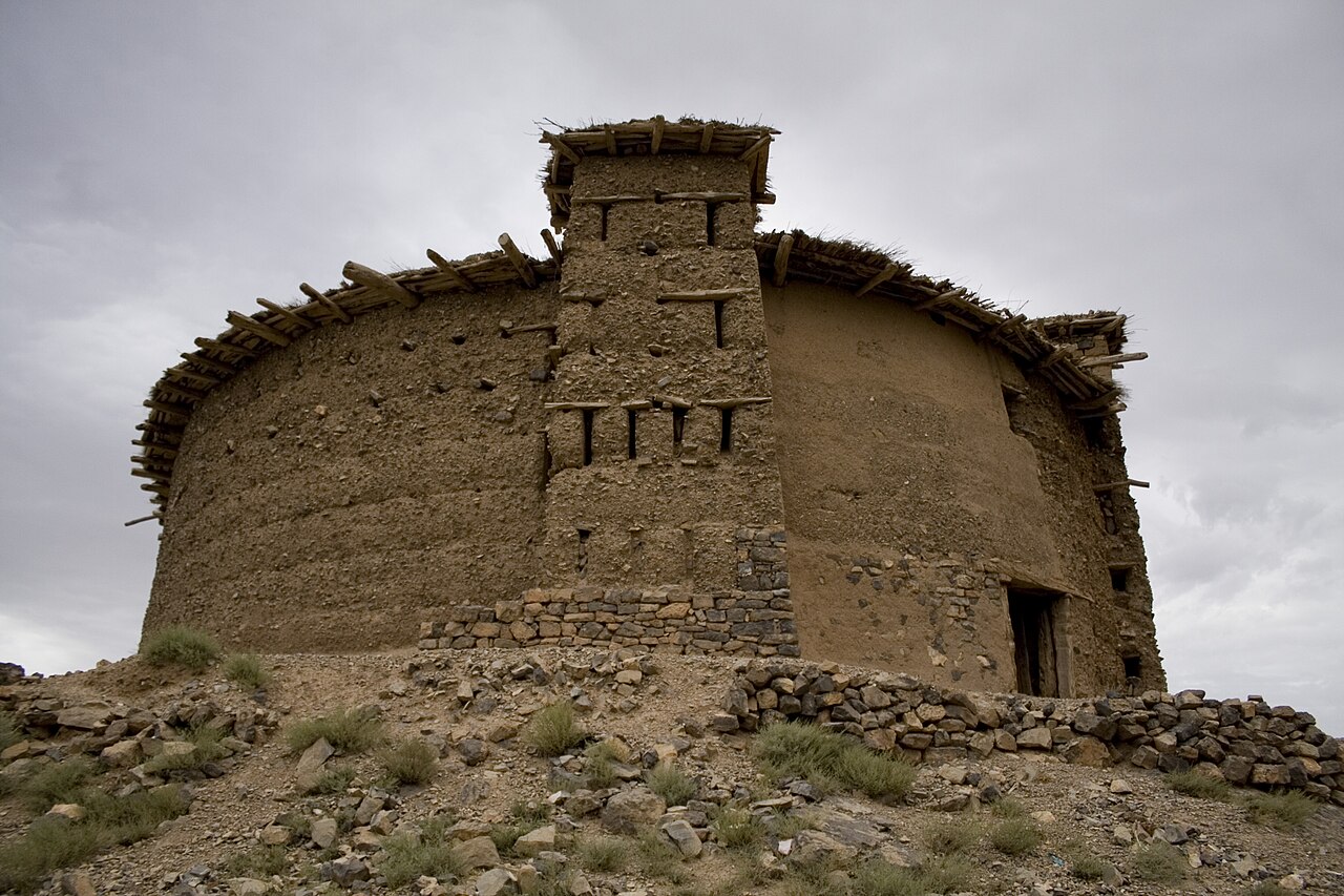
- The dinosaur footprints: sauropod and theropod footprints can be seen on the limestone rock near the village of Ibaqualliwn. Ask a local to take you there.
- The Zawyat Oulmzi ecomuseum: it presents Amazigh daily life, tools and textiles. Check its hours on the spot.
- Hikes: from simple walks between villages to multi-day treks towards the M'Goun massif, around Lake Izourar or the Taghia cirque. For high-altitude routes, take a local guide.
- Workshops: cooperatives and associations offer weaving and Berber cooking; ask your accommodation.

The valley is part of the M'Goun Geopark, recognised for its geological, cultural and natural heritage.
When to go
Spring (April-May) and autumn (September-October) are the most pleasant seasons: mild temperatures and colourful landscapes. Summer suits high-altitude outings, with nomadic families moving up near Lake Izourar from April to August. Winter brings snow and can cut the roads: find out before leaving.
What to know before leaving
- Altitude and weather: the valley lies between 1,800 and 2,400 m; nights are cool even in summer, so bring warm layers.
- Money: withdraw dirhams in Marrakech or Azilal; do not count on cash machines or card payment in the villages.
- Network: mobile coverage is patchy; download the map before leaving.
- Respect for residents: dress modestly in the villages (see what to wear in Marrakech) and ask before photographing a person.
- Budget: for the rest of your stay, see the budget for a trip to Marrakech.
Aït Bouguemez, Imlil, Ouzoud or another outing?
- Quiet hiking and villages, over several days: Aït Bouguemez.
- High mountains near Marrakech: Imlil and Toubkal.
- Waterfalls: the Ouzoud falls, on the same Azilal road.
- Beach: Essaouira.


